
Honey- we’re home! That’s right, after leaving Maine to drive to Georgia on March 20th , we returned to Maine by foot on September 27th. It only took us 6 months and 7 days to get there. But, just like when we arrived in Georgia by car, that was not the end of our journey, it was just beginning. Although we had just walked from Georgia to Maine, our end goal was still about 280 miles away.
One may think that with almost 2000 miles of hiking experience, that everything is almost a walk in the woods- think again. It seemed as though the real challenges had just begun.
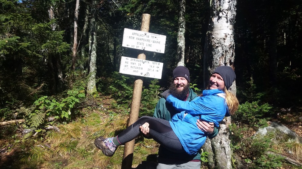
We went from New Hampshire, where they say live free or die, to Maine- Vacationland or the way life should be. Although they describe it as vacationland and say that’s the way life should be- hiking and living in the woods of Maine , in the fall- is not really what most would call vacation.
Pre trail me said there was no way we would still be hiking the trail in October in Maine. Yes, we have hiked in Maine through some of the coldest temparatures, even in February when the temps are below zero. The difference between day hikes in Maine, and backpacking in Maine (when your only home is a tent) is that it’s freaking cold. When the day is said and done, or even the weekend backpack trip – it’s generally a chance to stop and get real food, a cold beer, all served by someone else- then go home to a shower and warm bed. Instead, when you’re hiking the trail – when the day , weeks or months are said and done- you add boiled water to your dinner and fall asleep with the dirt, dried sweat, and sometimes blood, and tears from the day in your tent, hammock, or shelter.
So, with all of the above being said, we were still on the trail in October, and still havng fun despite the cold temps. We weren’t quite ready to go back to “civilization” just yet.
![20160927_143458[1].jpg](https://theintentslife.com/wp-content/uploads/2016/11/20160927_1434581.jpg?w=3264)
Similar to previous states, the further north we got- the better the views. With better views, usually come more complex climbs. Not more than 1 mile after we cross the border into Maine, were we doing hand over hand climbs onto large boulders, squeezing between crevices of rocks and rock sliding. Oh yeah- we were rocking. ![20160928_113330[1].jpg](https://theintentslife.com/wp-content/uploads/2016/11/20160928_1133301.jpg?w=3264)
We had been on auto pilot for some time and here we were, in our 14th state, and have been out here for 6 months- and now we needed to think a little bit more in regards to where and how we should be stepping, and reaching for things. You get to the top of one giant rock obstacle, to then be able to see further and have to try to think about your next moves. I was a big fan of butt scooting on the trail, in fact- one of my most frequent words of advice on the trail was that you were never too cool to butt scoot. But (no pun intended), despite being a regular fan of butt scooting down rocks, some rocks were way ahead of me and I would just slide right off. Luckily, Snorlax was generally close by to catch me and prevent me from falling over the edge. I ripped a lot of pants this way.

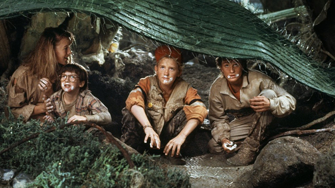
Mahoosuc Notch was the first big test we had once we entered Maine. It is described by our guidebooks as the most difficult or fun mile of the AT. It took some people anywhere from one hour to about three hours to complete. Generally, one mile takes us anywhere from 15 to 30 minutes. Of course it rained the day before we were going over Mahoosuc Notch, and also sprinkled during our trek over this section. It took us about 3 hours to complete this section. We were having flashbacks of Pennsylvania a.k.a. Rocksylvania all over again. I felt like the cast of, “Honey I Shrunk the Kids” but with about 30 pounds on my back, and instead of going through grassy areas, we were going through the aftermath of dynamite in a Mountain. In some sections you could hear a river running below you, and you knew that if something fell down there, it was done. The same day we went up what is considered the steepest part of the AT. The goal for that day had initially been 15 miles, but by the time those areas were completed, we called it good at about 7 miles.

Skye Stalker did not do the Mahoosuc Notch section. Although we believe she probably could, it would have taken us longer , as well as we did not want to risk her getting hurt. Luckily, my brother in law , Blake and my sister Missy had taken Skye at one of the last road crossings and returned her at the next road crossing. While we were out hiking the toughest mile in the rain, our trail boss was chilling on a couch, in a warm house, eating as much she wanted. It really is a dogs life.

Oboz sent us another pair of shoes. That marked our 4th pair on the trail, as well as our 4th season. We hit the 2000 miler marker not too long after we entered the state of Maine.
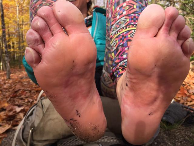
The state of Maine brought us tears of joy, and pain. Snorlax , amongst many other hikers had some days where they wanted to quit the trail. Our bodies were beat up. My left knee had some persistent pain which slowed me down a lot, especially going down mountains. I developed trench foot on my feet, which also affected my speed and enjoyment in hiking. I had also lost two toe nails by this time. I was ready to become a foot model.
Unlike R.Kelly, our minds were telling us yes, but our bodies were telling us no. We did not make it this far to just give up, but boy- was the trail really testing us.
We had been in Maine for about a week when we walked into the Rangeley area, which is not far from Snorlax’s hometown. His parents, my in laws- Greg and Jeanette- took us in and fed us some amazing home cooked meals, got us showers and laundry. They even took Skye again for some sections to let her rest up. (they won’t ever let us get pictures of them so here is the closest I can get)


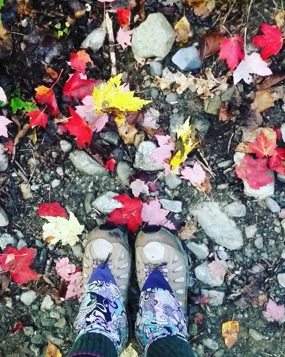
Piazza Rock, Saddleback and the Bigelow mountains were the next big milestones that we would be conquering. While the cold was a downfall of hiking this late in the season, the colors make up for it. Fall is definitely one of my most favorite seasons in Maine.
If you find yourself in the Rangeley area and looking for a small hike, but also maybe a good place to do some business and play a game of cribbage with your friend, I recommend the Piazza Rock trail hike and swing by the shelter. The Piazza Rock shelter has a double seater privy, with a cribbage board. You do need to bring your own cards and may need to make your own pegs.
The Bigelows were beautiful. Not that anything else we have seen has not been beautiful. It was amazing to go through so many areas that I have never seen before and I had lived in the state practically all my life (minus a brief period that I went to college in NH). Any picture I took along the trip, I instantly felt like it did not do it justice. In order to see the beauty, you had to just be there- in that moment- and nothing else.


One of our obstacles in Maine was fording multiple rivers. It was good and bad that we have had a drought this year because the bodies of water weren’t very high in some areas. This would make it easy to ford, but difficult to have a drinking source. We were on somewhat of a deadline when crossing a section of the Kennebec River. There was a “ferry” (it was a canoe) service for this section as it is dangerous to cross on your own.The ferry service stopped October 11th, or you would have to call and pay for the service. We made it by October 10th. Skye decided that she didn’t want to take the ferry and swam across. Not sure she was expecting the water temp she jumped into but made it across safely.
The ferry was featured in a new artictle in one of our local papers: http://bangordailynews.com/2016/10/13/outdoors/new-appalachian-trail-ferryman-helps-take-hikers-across-dangerous-river/.

While we were close to home, we grabbed our cars and slackpacked ourselves for about 80 miles or so. Slackpacking actually didn’t make our trip easier like expected, and was actually more of a headache. We slackpacked from Rangeley to Monson and called it good. We parked the jeep in the 100 Mile wilderness with boxes full of resupply food, and of course some beer. We did this so we wouldnt have to carry about 12 days worth of food through that stretch, and have a little bit a celebration drink with our trail fam.
Somewhere after the ferry, but before the 100 mile wilderness, Skye retired from hiking the trail. She had made it over 2000 miles. In one of her excursions of chasing a chipmunk, and returning with her pack lopsided – she was slightly limping. We removed her pack to see if that would help but it didn’t make much difference. Snorlax carried her to the next nearest shelter, which happened to be close to a road. Our friend Merlin slackpacked to where one of our cars were parked and drove up to get us and Skye. She rested the night and the next day she seemed to be fine, but we knew it was a sign that she needed to go. We got her to my in laws where she remained for the rest of the trip.


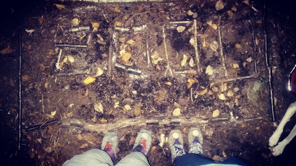
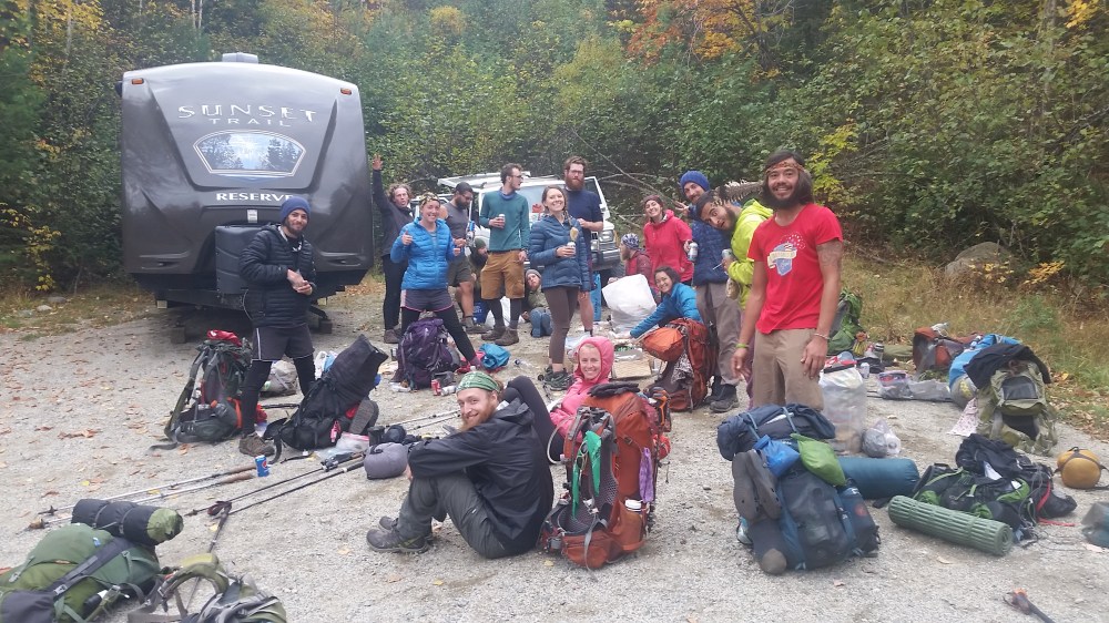
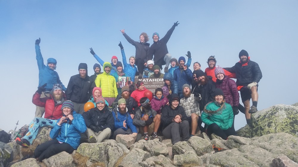
The 100 mile wilderness some may be asking- what’s that like the 100 acre wood where Winnie the Pooh and his friends chill? Not exactly. It is generally considered the “wildest” part of the AT. Also considered one of the “most challenging to navigate and traverse”. Because this section is so isolated, food and assistance is not easily attainable- therefore they recommend you carry a lot. One of the pictures above is a sign which you see prior to entering the 100 mile wilderness. The boxes pictured above are filled with food, snacks, stove gas, and toiletries which Snorlax and I had left over from our pre trail prep. We filled the jeep with this stuff and parked it in the wilderness. The other picture above is our family just about to enter the wilderness. Look at the smiles in those faces. 100 miles left of this journey, and here we are- together, like we have been for the past 6 months. (from L-R: Snorlax,Shaggy, Musicbox (me), Game Warden, Spam, Sniper, Earl Grey, Frisky, NP, Pinky and The Brain, Tourmin, Mama Bear, Dayman and Hollywood). This is our family (missing a few in this picture).
When we were parking the jeep in the wilderness- some other hikers ran up to us, asking us if we knew how close town was- because they were low on food. It was a great feeling and perfect timing on their part that they approached the right vehicle, at the right time. We were able to feed the two hikers for another 4-5 days so they could make it to Katahdin comfortably.

Approximately 70 miles into the wilderness, we made it to where the jeep was parked filled with our goodies. It was the best feeling being able to help other hikers. There had been multiple people who had run out of food and would have been in some tough spots if it weren’t for the jeep. All my overplanning with food worked out for all the hikers. It was also a great opportunity to have my homemade dehydrated meals tested out by someone else other than my husband.
The last few days we encountered some snow on the top of Whitecap Mountain, and fought some rain.

Above photo courtesy of The Brain
We had some near death encounters which could have been caused by crazy fires, or slipping and falling, and maybe some from people getting hangry and emotionally drained. I remember at one point slipping while going down a mountain and going flying in the air, parralell to the ground. I landed hard on my back right on a rock and a root pertruding out of the ground. If it was not for that backpack I was wearing, our trip would have ended a lot sooner than planned. It’s these moments where I need to just step back, sit down and take a deep breath. I did not make it this far to just end my trip like that.

There we were, less than 100 miles left to Katahdin. We could finally see her. We have been chasing her for months now, and she’s just been sitting here looking pretty. After over 2000 miles, and over 6 months of snow, rain, humidity, heat, scraps, bruises, poison ivy, trench foot, and various injuries, lack of showers, dirty smelling clothes,tears, bland food and spending time away from our comforts of society- she didn’t even dare show her face. Those clouds were blocking the first chance we got to see her. But at this point, we were able to tell her that there was no stopping us now.


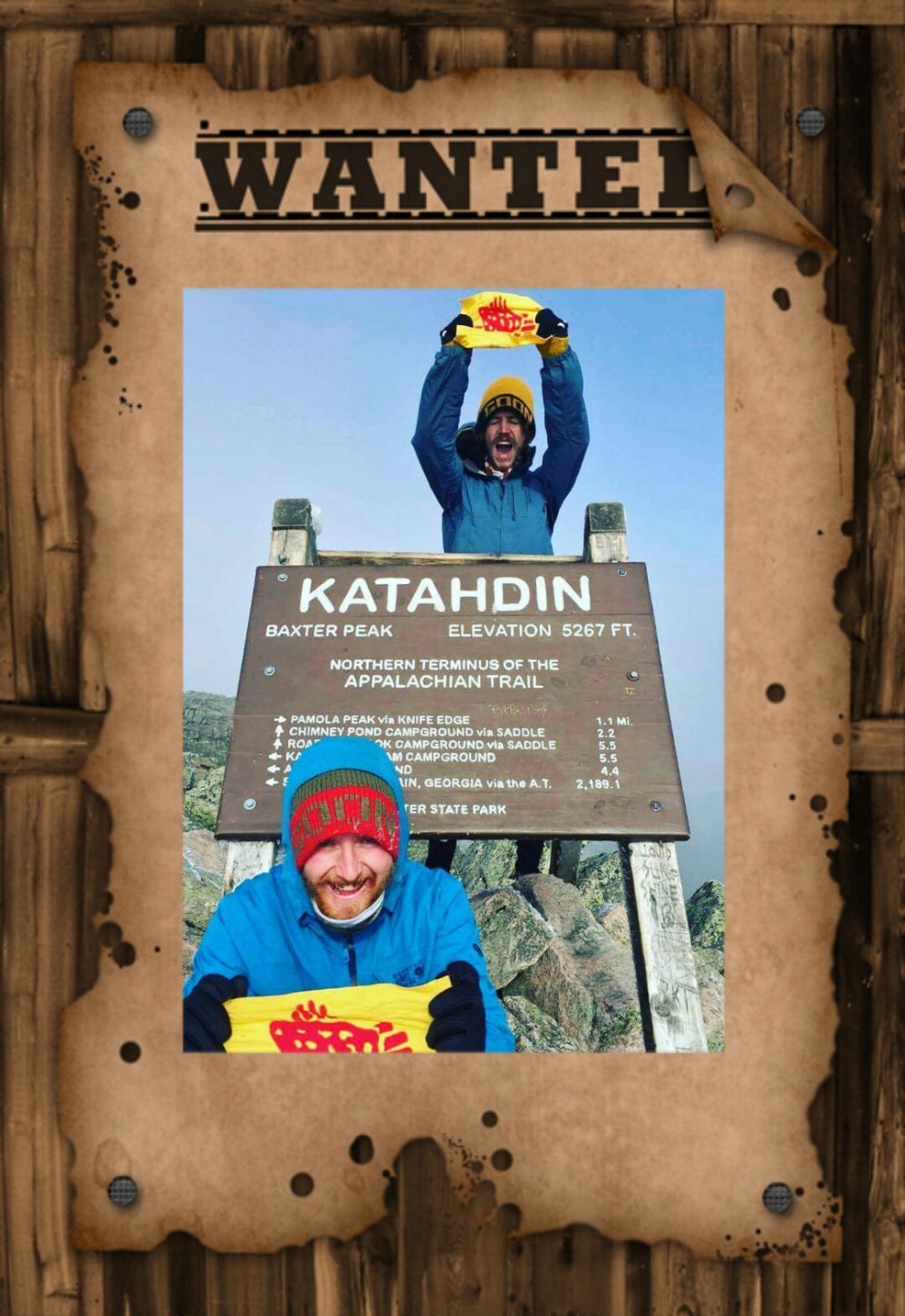
Prior to summiting Katahdin we stopped in Milinocket. This gave us a chance to pick up a package from our trail family who left in Harper’s Ferry- Cheesus and Two Step. We also picked up some balloons for the summit. In the box from Cheesus and Two Step were some personalized flags for Pinky and The Brain, Game Warden and Snorlax, Skye Stalker and I (amongst some other awesome treats). The flags were customily made by them – therefore made with love.


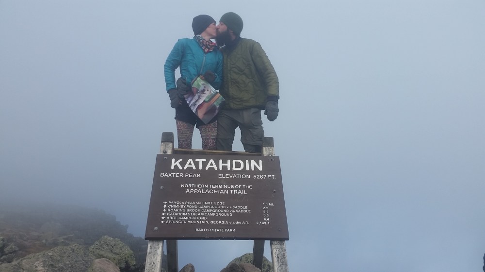
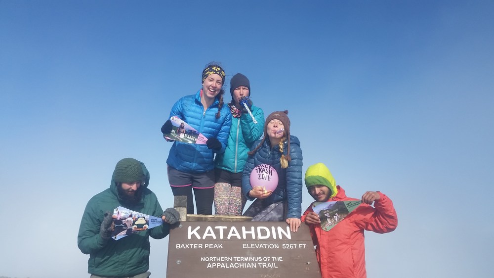
We summited Katahdin on October 19, 2016. The skies were blue and there were clouds, but they kept moving fast- just like our emotions. It took us 6 months and 27 days. Dogs are not allowed in Baxter State Park where Katahdin is. Skye stayed with my mother and father in law until we finished. Skye was there in spirit. We summitted with some of the best people ever. We were the kids who slept late and procastinated because we knew it wasn’t a race. It was all about the smiles, not the miles. Many said we were behind- but behind what? We just had the journey of a lifetime. We gave up so much to be able to go after one of our dreams. And despite how tough it got at times, we pushed through and made it. We were surrounded by some of the kindest people we have ever met not even while just on the trail, but also on our summit day. I still remember getting dropped off from Gainsville to Amicalola Falls from the cab driver who ripped us off on the fare, but also said we wouldn’t make it 6 months in the woods. Well you’re right Mr. Cab Driver, we didn’t make it 6 months. We made it 6 months and 27 days- so put that in your pipe and smoke it.
Pictured below are Daddy and Wakka, other family members who were not there when we summited

You must be logged in to post a comment.